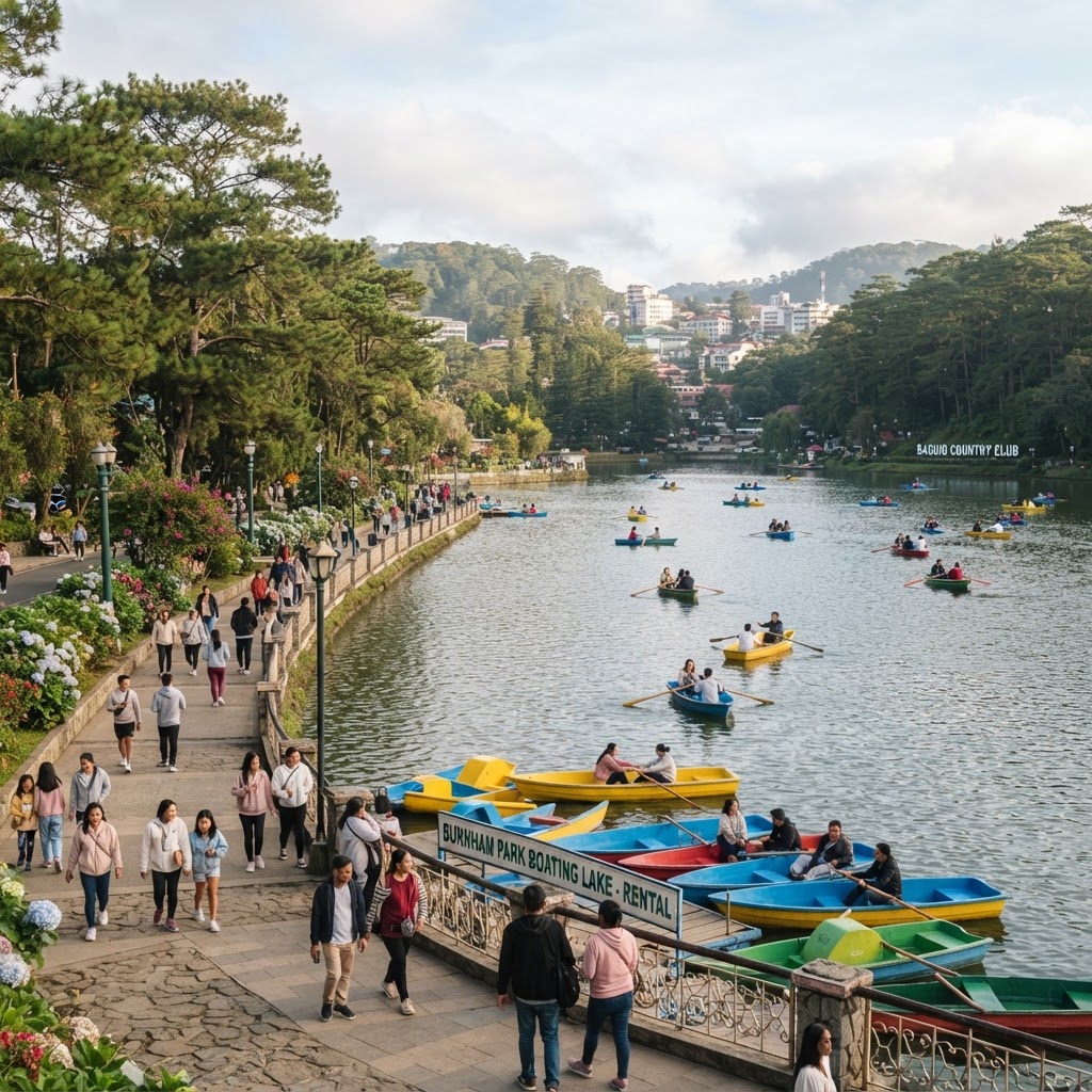
Burnham Park and the City Core
The green heart laid out in the city's founding plan: a lake with rental boats, bikes and promenades, with the downtown streets, public market, and cathedral within a short walk of its gates.
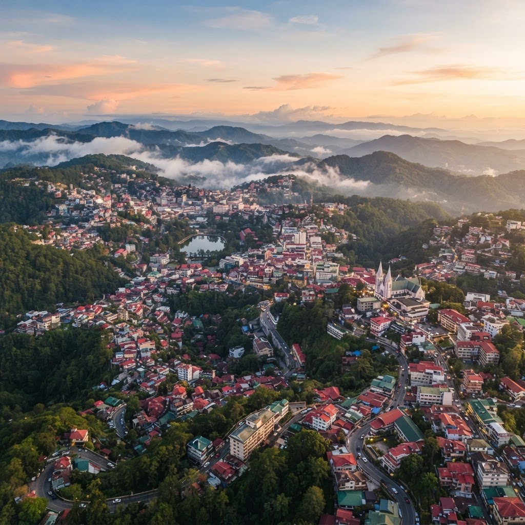
A cool highland city in the Cordillera — pine ridges, a walkable downtown of parks and markets, crafts and creative culture, and Benguet excursions just beyond the city line.
Baguio is a highly urbanized city in the Cordillera Administrative Region of northern Luzon — geographically within Benguet province, though administratively independent of it as a chartered city in its own right. Set at roughly 1,500 meters above sea level, it has long been known as the Philippines' 'Summer Capital': a place where the air is cool, pines line the ridges, and lowlanders arrive by the busload to escape the heat. What began as an American colonial hill station in the early 1900s — laid out along a plan by the urban planner Daniel Burnham, whose name the central park still carries — has since grown into a busy, full-year mountain city rather than a seasonal retreat.
The city is compact and walkable at its core. Downtown clusters around Session Road — the commercial spine — with Burnham Park at its center, the public market nearby, and the cathedral above. East of the center, the ridges hold quieter residential neighborhoods and viewpoints such as the Mines View Park area, while Camp John Hay — a former American rest-and-recreation base turned pine-forested parkland on the city's southeastern side — preserves some of the city's woodland character. Baguio's boundaries matter for planning: it is a city, not a municipality of Benguet, and its immediate neighbor is La Trinidad, the Benguet capital — a separate town in the valley to the north, where many visitors combine strawberry farms and valley views with their city stay as a nearby Benguet excursion.
Culture gives Baguio its depth. The area is the traditional home of the Ibaloy, one of the diverse Indigenous peoples of the Cordillera — a region whose peoples, languages, and traditions are distinct from one another and should not be treated as a single interchangeable culture. That heritage flows through the city's woodcarving and weaving trades, its artist communities, and its markets, and in 2017 the city was designated a UNESCO Creative City of Crafts and Folk Art. Galleries, museums, and artist villages around the city present highland art and heritage — engage respectfully, and treat crafts and traditions as living practice rather than scenery.
The practical art of a Baguio trip is pacing: a downtown best explored on foot, viewpoints and parks spread over the ridges, and nearby Benguet excursions a short ride beyond the city line. Baguio is also a working regional center — traffic and crowds swell sharply on weekends, holidays, and festival weeks, so timing matters as much as destination choice. And getting there is a land journey by design: the city sits at the top of mountain roads climbed from the lowland plains, with Manila the common gateway for travelers who continue overland.
The green heart laid out in the city's founding plan: a lake with rental boats, bikes and promenades, with the downtown streets, public market, and cathedral within a short walk of its gates.
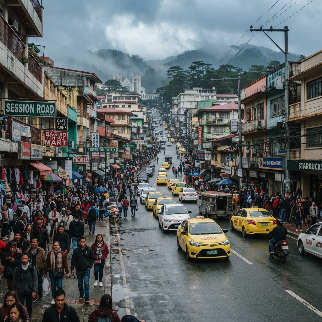
Baguio's commercial spine — a walkable slope of cafés, restaurants, shops, and street life that carries the city's everyday energy from morning to night.
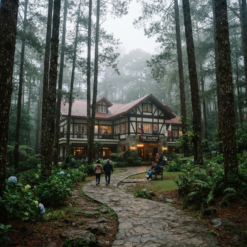
A former American rest-and-recreation base turned pine-forested parkland on the city's southeastern side: pine groves, heritage buildings, and quiet walking trails.
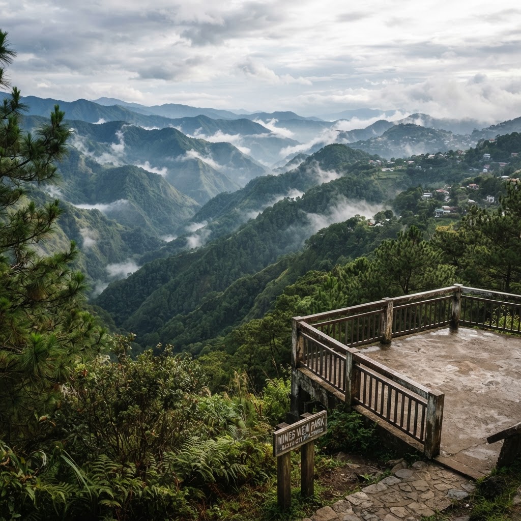
On the city's eastern edge, a classic ridge viewpoint over Benguet's mountain country — best early in the day, before crowds build and before the mist settles in.
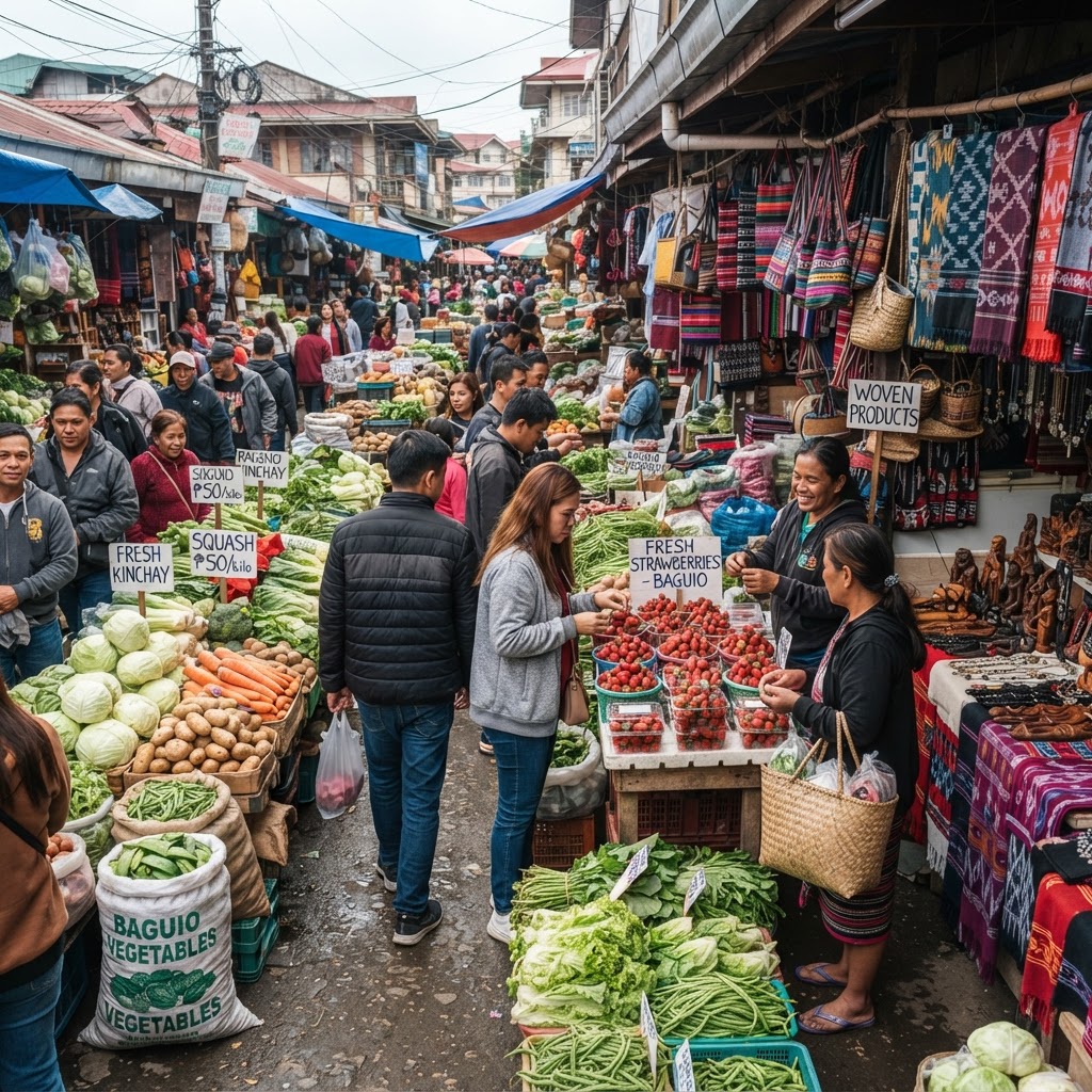
From the public market's highland produce and woven crafts to galleries and artist villages, Baguio carries its UNESCO Creative City of Crafts and Folk Art identity visibly — schedules and exhibits vary, so confirm details locally.
Baguio is a year-round city, but the coolest, driest stretch typically falls from around November to February — peak season, when crowds and accommodation demand are at their height and February's Panagbenga festival month brings its own surge (dates vary yearly). March to May stays busy with the lowland summer escape; from roughly June to October the rains return and typhoon-season weather can affect the region. No month guarantees particular temperatures or conditions — check current weather advisories when planning.
Explore accommodation options for your Baguio trip and confirm current availability directly with Trip.com.
We may earn a commission if you book through this link.
Search flights to Manila as a gateway for your Baguio trip, then plan the separate onward journey to Baguio by land. Confirm current flight options directly with Trip.com.
We may earn a commission if you book through this link.
Explore a Baguio City day-tour experience departing from Manila and confirm the current itinerary, inclusions, schedule, and availability directly on Klook.
We may earn a commission if you book through this link.
Organized travel in Baguio takes coordination — island logistics, weather windows, and local arrangements. Tell our team what you have in mind and we'll help you put a workable plan together.
Talk to our teamWe only recommend what's real — no invented packages, no invented prices.